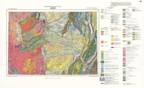
Carte Pédagogique LYON ET SES ENVIRONS à 1/80 000
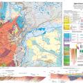
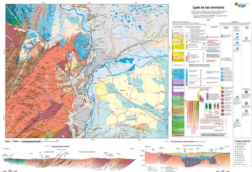
Cette carte permet de comprendre pourquoi de manière contrintuitive les plus vieux terrains occupent actuellement les positions topographiques les plus élevées, et de manière générale comment les structures et l’histoire géologique du domaine centralien s’articulent avec celles du domaine alpin. Elle explique la localisation préférentielle des cultures maraîchères, l’étalement diff érentiel de l’urbanisation de Lyon, et ultimement le gradient social existant entre l’Ouest et l’Est de l’agglomération.